If you’re impatient, skip to the bottom of this post for an explorable/interactive map of Hawaii Island!
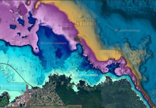
The underwater world is largely unseen by most, in part because there aren’t many good maps of underwater topography. While we have enjoyed highly detailed topo maps of landscapes and mountains for a very long time, this seems to have been overlooked for those of us who explore reefs and such.
There are somewhat useful nautical charts with soundings plotted for ship navigation, some low-resolution vector charts for boat consoles, and a few paid phone apps (e.g. Navionics) that provide basic bathymetry layers. But none of these are made for people who actually go into the water (namely, divers.)
Our tax dollars at work
Fortunately, NOAA has made some rich and useful underwater digital elevation model (DEM) data publicly available, and these can be processed into maps specifically made for us!
justinthedeeps.com
I started exploring the NOAA data while ‘stuck’ diving in Hawaii during the onset of the COVID-19 crisis. I grew up near Pāhoa, on the doorstep of uniquely fresh and wild windward shores, where all manner of people of sea life thrives on some of the newest land on Earth (including very fresh lava…) Some of the most intact marine ecosystems hide on these clean and dangerous shores, inaccessible to almost everyone. That is especially true after the 2018 flows took Kapoho and most of Pohoiki (but not all…)
The young volcanic topography of the “big island” (Hawaii) makes for very adventurous reefs and shores, particularly for those brave enough to shore dive. There isn’t much sand, and it doesn’t take much for the punchy surf to put a diver in a life-threatening situation. I have endured involuntary breath holds in the surge of the new Pohoiki while freediving to see what is already growing back there (a lot!), and I once broke a pinky in a puka just getting in at relatively ‘calm’ Leleiwi (I kept diving, of course!)
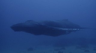
Guided boat diving is easy to recommend, if you have any doubts. Spoiler: Kona is a no-brainer for easy destination diving, but my most memorable and fresh boat dives have been just outside of Hilo near King’s Landing, thanks to Kimo and Co at Hilo Ocean Adventures, and Philip (East Hawaii Divers) who showed us around underwater. There are mantas, humpbacks and humpbacks there too. Be warned, the seas move more on the windward side–which also keeps it fresh.
Some of the most interesting and adventurous diving can be done from shore, with a DPV and a rebreather (or multiple ordinary tanks) that can get you out of the typical beach park radius. For that, a glance at the maps, conditions and topography can be helpful.
While rehabilitating cylinders and hand-blending trimixes under the tropical barn roof of tireless miracle diver Gregg Stanton, I spent many a weekend plotting a course to the edges of new reef features that beckoned on screen.

justinthedeeps.com
What (and who) is out there?
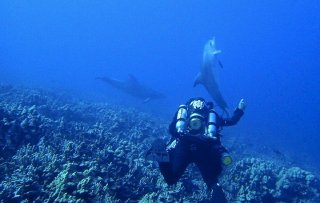
With good data in hand, it was possible to estimate precise distances and transit times via diver propulsion vehicles (DPVs) to new underwater topographical features at precise, known depth targets. Together with others including @oceanadventureshawaii, @joesjunglegym and @campainhakirk, we visited new corners of reef systems while escorted by pods of curious dolphins (who approached us from above, rather than us to them!)

justinthedeeps.com
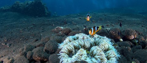
Since then, I have religiously pored over any bathymetric data that is available where I dive. This includes Hawaii, Indonesia, and even the familiar waters of the Salish Sea / Puget Sound.
Maps for all
Recently, I dived deeper into writing a data processing pipeline that produces custom topo maps for divers throughout the whole Puget Sound, and have been serving them up for public use on PnwDiving.com. Try it out if you dive these waters!
This does get a bit involved with all of the data, various tools and approaches for working with and re-rendering it, and setting up tile servers on cloud CDNs. Tile sets quickly run into the millions, for higher zoom levels over large areas!
Here is an explorable bathymetry map for the Island of Hawaii, rendered specifically for the kinds of depths that divers (including ’technical divers’) are interested in:

This is a demo map, that could in the future become more featured. I have included pins for some of the wilder windward sites, many of which are beyond the capabilities of all but the local lobster divers. The DNLR list of day-use moorings that the Kona dive shops established and maintain is also included, which highlights most of the sites frequented by vacationers who are fortunate enough to invest in a full-service experience.
If you are interested in more of this, or more types of mapping and applications, please contact me to discuss!
You can see more of the maps we are producing over at PnwDiving.com, where I have been assisting in developing map features to provide these explorable diving maps in conjunction with visibility reports and dive site info to divers throughout the ‘Pacific Northwest’ of the US (and Canada).


