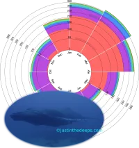
@justinthedeeps on Mon, Mar 10, 2025
@justinthedeeps on Tue, Jan 21, 2025
@justinthedeeps on Sun, Jan 12, 2025
@justinthedeeps on Tue, Dec 10, 2024
@justinthedeeps on Wed, Dec 4, 2024
@justinthedeeps on Mon, Sep 30, 2024
@justinthedeeps on Thu, Sep 5, 2024
@justinthedeeps on Sat, Aug 24, 2024
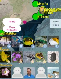
Gmail: justinthedeeps
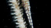
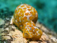
Catching up with cetaceans